The Biggest Roofs in San Antonio Are the Worst Ones to Inspect on Foot
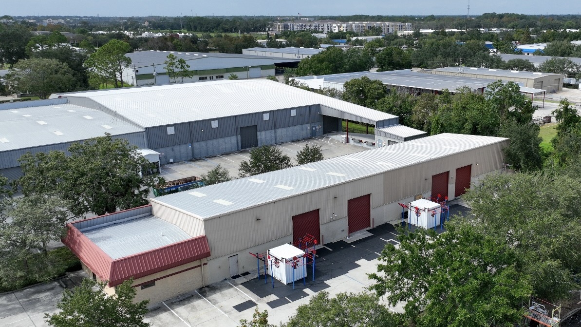
Picture the roof on a fulfillment building near the I-35 logistics belt around Selma and Schertz, a distribution center out at Port San Antonio, or a campus building in the South Texas Medical Center. Hundreds of thousands of square feet, dozens of drains and curbs, and a membrane that does not enjoy being walked. Sending a two-person crew to cover all of it by hand eats a full day or more, leaves scuff marks and footprints on an aging surface, and still tells you nothing about the water already hiding inside the assembly. We fly those roofs instead. A drone carrying a high-resolution camera and a radiometric thermal sensor maps a roof that size in a fraction of the time, finds problems the eye cannot, and never sets a boot on the membrane.
The reason most of our San Antonio inspection calls turn into thermal flights rather than clipboard walks is simple: aerial infrared finds trapped moisture, and trapped moisture is the single finding that actually moves a budget. Everything else a walk can eventually catch. Water inside the insulation, it usually cannot.
How Infrared Sees Water You Can't
Wet insulation and dry insulation behave differently once the sun goes down, and that difference is the whole trick. All day a San Antonio roof bakes - surface temperatures on a dark membrane climb well past 160°F on a clear afternoon. After sunset, the dry areas of the roof dump that stored heat quickly, but the saturated areas hold onto it, because waterlogged insulation carries far more thermal mass. We fly the radiometric sensor in that evening window, and the wet zones glow as warm islands floating in a cooler, dry field. Those warm patterns trace almost exactly where moisture has worked into the assembly.
A thermal image is a lead, not a verdict, and we treat it that way. We mark the warm anomalies, then confirm a representative sample of them with targeted core cuts, so we can prove we are reading trapped water and not a buried duct, a sun-warmed mechanical curb, or standing surface ponding. Fly the whole roof, then verify the flags by hand - that pairing is what turns a pretty picture into a report an owner or an insurance adjuster will actually stand behind.
What the Visual Pass Documents
The same flight delivers a high-resolution visual survey of every square foot. From above we catalog open and fishmouthed seams, splits and punctures, ponding rings where water lingers long after a storm, cracked pipe boots and failing pitch pans, lifted or backed-out edge metal, and clogged drains and scuppers. It also captures storm damage - hail bruising, wind-displaced flashing, debris impacts. That matters here because San Antonio's roughly thirty inches of annual rain does not arrive gently; much of it comes in violent spring and early-fall thunderstorms that dump several inches in under an hour and overwhelm undersized drains. After a night like that, an aerial pass lets us assess a large roof within a day or two instead of scheduling a multi-day walk while water keeps finding the weak seams.
Why Flying Beats Walking on Roofs This Size
- Zero foot traffic on the survey. Every step on a hot, aging membrane risks damage. The flight keeps people off the roof entirely while we gather data.
- Whole-roof coverage, fast. A drone images the entire field in one visit and stitches it into a single map - not a sample of wherever a person happened to walk.
- Hidden moisture, mapped to scale. Thermal imaging shows saturated insulation across the full roof, and that map is the most important input to whether a roof gets repaired, recovered, or torn off.
- Reach without rigging. Crowded mechanical fields, fragile skylight runs, steep transitions, and tall multi-level roofs are all reachable from the air with no ladders or fall-arrest setups over occupied space.
- Documentation that holds up. Geotagged imagery and dated thermal maps give owners, property managers, and insurers a defensible record for warranty claims, capital planning, and disputes.
FAA Part 107 and Flying in San Antonio Airspace
Commercial drone work is regulated, and we run it by the book. Our flights operate under the FAA's Part 107 rules for commercial small unmanned aircraft, which govern who may fly, where, and how. That is not a formality in this city, because controlled airspace covers a large share of the metro. Joint Base San Antonio's airfields - Lackland, Randolph, and Kelly - along with San Antonio International and Stinson Municipal all generate airspace restrictions, and a flight near any of them can require LAANC or manual airspace authorization before we are legally allowed to launch. We check the airspace for your exact address, secure any clearance required, keep the aircraft within visual line of sight, and stay off of people who are not part of the operation. On the ground we coordinate roof access for the core-cut verification and keep clear of active loading docks and equipment yards while we work.
The Report You Walk Away With
The deliverable is built to act on, not to file away: an annotated visual survey of the whole roof, a thermal moisture map with the suspected wet areas outlined, core-cut confirmation at representative anomalies, and a plain-language summary of what we found and what we would do about it. For any roof heading toward a recover-versus-replace decision, that moisture map is the document the whole call turns on - a dry, sound roof can often take a recover overlay at a fraction of tear-off cost, while a roof with widespread saturated insulation has to come off no matter what the budget was hoping for. For owners running a portfolio of buildings across the metro, an annual flight builds a year-over-year record that turns roof spending from a string of emergencies into a planned line item.
Drone Roof Inspection Questions From San Antonio Owners
How does a thermal scan find moisture without opening the roof?
Saturated insulation holds the day's heat longer than the dry roof around it. We fly the radiometric sensor after sunset, when the wet areas read as warm zones against the cooled-down dry field, and that signature maps where water is trapped in the assembly. We then confirm a sample of the flagged areas with targeted core cuts, so the findings are proven rather than guessed.
Is a drone inspection really better than a person walking the roof?
For large low-slope roofs, clearly yes. A flight covers the whole surface in one visit, keeps people off a hot or fragile membrane, reaches areas that are unsafe or awkward to walk, and adds thermal moisture detection a visual walk simply cannot provide. We still do hand verification at the flags - the two methods work together rather than replacing each other.
Do you need FAA clearance to fly my building?
Frequently, yes. We operate under FAA Part 107, and much of San Antonio sits in controlled airspace tied to Joint Base San Antonio, San Antonio International, and Stinson Municipal. We check the airspace for your address and obtain any LAANC or manual authorization required before we launch.
How soon after a storm can you assess the roof?
Usually within a day or two, weather and airspace permitting. After the heavy thunderstorms common here in spring and fall, an aerial pass lets us survey a large roof for hail and wind damage far faster than scheduling a full walk, which gets a documented condition report into an insurance claim while the timeline still counts.
What exactly do I receive at the end?
An annotated visual survey of the full roof, a thermal map outlining the suspected wet insulation, core-cut confirmation at representative anomalies, and a written summary with recommendations. It is structured to support warranty claims, insurance documentation, and repair-versus-replace decisions.